Menu

Tag : 3D mapping

Case Study: Surveying an Industrial Site for Regeneration, Using Drones

Case Study: Surveying an Industrial Site for Regeneration, Using Drones

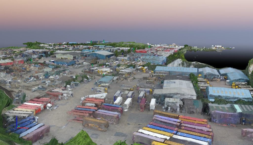
Working with Waterman Infrastructure & Environment and Thurrok Borough Council to map a large industrial site in Purfleet, Essex, Bee Aerial completed aerial surveys to provide detailed, high-resolution models using a Phantom 3 drone and Pix4Dmapper image-processing software. The surveys will be used to plan and direct a wide scale regeneration project in the area. […]

How Drones are Shaping the Future of Surveying

How Drones are Shaping the Future of Surveying

Over the last few years, drones have revolutionized photography by putting a roving eye in the sky whenever and wherever it is needed. Technological innovations are now extending those advances to other fields so that drones can not only photograph and film from the air, but via aerial surveying can provide detailed 3D surveys for architects, […]