

Over the last few years, drones have revolutionized photography by putting a roving eye in the sky whenever and wherever it is needed. Technological innovations are now extending those advances to other fields so that drones can not only photograph and film from the air, but via aerial surveying can provide detailed 3D surveys for architects, surveyors and developers.
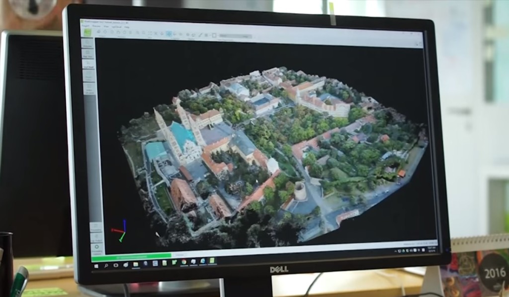
Pix4D offers an industry leading solution in the field with their Pix4Dmapper software which can be used to capture buildings and landscapes. Using the technology, the operator’s quadcopter is set on a programmed flight path to capture an image library of the area being surveyed. By compiling these images the software is able to build a detailed 3D point cloud – points in space that map out the edges of a building or landscape, much like a motion capture suit used for CGI. These points can then be used to map out surfaces and apply textures and graphics. The ultimate result is a complex 3D model that can be created in minutes, capturing a level of detail unparalleled by laborious traditional surveying techniques; and just as drones can capture aerial imagery at a fraction of the cost of using a plane or a helicopter, the same is true when it comes to surveying. What’s more, the point cloud is geo-referenced, meaning that a photorealistic 3D model can be precisely placed on a real world map, with a level of error of centimetres to the kilometre.
Video footage of Pix4Dmapper in action as well as details of updates to the latest version
The software also provides features that are invaluable to specific industries: farmers can use heat mapping of their fields to optimize the yield of their harvest; construction firms can calculate the extraction volume of earthworks to be removed; and environmental agencies can closely monitor the changing shape of the land and levels of natural resources.
A 3D model produced by Pix4Dmapper, which you can manipulate in real time
A fact fast becoming known is that drones have a wide variety of uses in development, surveying and construction, that go far beyond providing technical surveys. Quadcopters can nimbly provide aerial photography of building sites, can document inaccessible rooftops and can capture views from buildings that don’t yet exist, all without the use of a crane. These new capabilities are proving invaluable in the hands of estate agents and architects, using images for marketing purposes and to get views of development in action, which were never previously possible. Right now drones are running the length of power lines and sweeping under oil rigs and bridges to inspect for damage, cheaply, efficiently and without endangering human life. Looking at the future of drones in industry, the sky’s the limit!
If you would like to commission surveying services with BeeAerial just drop us a message at marketing@beeaerial.co.uk.